

The short answer is, it’s highly likely. But what does this mean for you? Let’s take a step back first though and look at some context.
What is Plan Change 78?
Plan Change 78 (PC78) is Auckland Council’s intensification plan change- including changes required by the National Policy Statement on Urban Development (NPS- UD) and incorporating the Medium Density Residential Standards (3 houses, 3 stories high etc), also called the MDRS. You can find out more about the background here.

Why the change?
PC78 created a number of issues in Auckland, including:
- The MDRS enables growth almost everywhere in urban zones rather than focusing it in areas that had the infrastructure and other services planned or available to service it and create quality urban environments.
- As this was an unexpected change at central government level, local Council’s weren’t aware of it and hadn’t planned for this in their long-term planning- there was no funding for new services in areas where growth had been restricted before and was now potentially tripled. In Auckland, this was most evident in Single Houze Zones (which in general can only accommodate one dwelling) that were required to be significantly upzoned by the MDRS (and PC78).
- The MDRS legislation didn’t allow Councils to “opt out”. This created issues in areas where development wasn’t appropriate, such as in floodplains or in areas experiencing (or expect to experience) coastal erosion or inundation due to climate change. The 2023 floods in Auckland highlighted this issue even further.
- In Auckland, the Auckland Unitary Plan (AUP) already provided for the projected growth in the region.
What’s allowing this new change?
The MDRS legislation was, until recently, mandatory- Tier 1 Councils were required to implement it through a plan change (Plan Change 78 in Auckland). After coming into government, National changed their mind and sought to make it optional however the actual change to the legislation to allow that only obtained royal assent in August 2025. It had been widely communicated that the change was coming, albeit slowly, and Auckland Council staff had been working on a draft (replacement) plan change behind the scenes (this was also widely known about, but not the specific content). You can learn more about the history in our blogs, such as here.
Due to very tight legislation timeframes, Auckland Council met a few days after royal assent, to discuss the draft plan change, process and agreed to start progressing consultation with local boards, government ministries, other local authorities and mana whenua.
What’s in the draft plan change?
The draft plan change is a relatively large document, but it relates to urban areas in Auckland and how they can develop. The main changes when compared to Plan Change 78 are[1]:
- there are stronger controls relating to managing risks from flooding, coastal hazards, landslides and wildfires
- there are changes to the zoning (down-zoning) of properties that are at the highest risk from flooding and coastal hazards
- MDRS has been replaced with different/improved standards
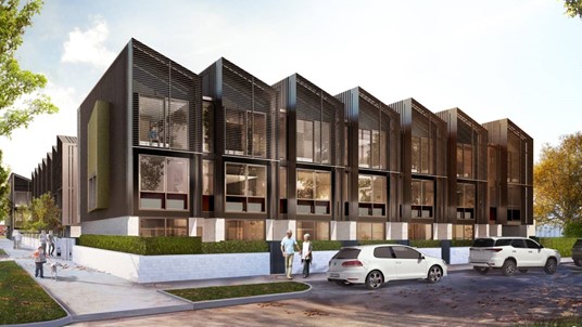
- there is an increase in the amount of land zoned for two-storey medium density housing (Residential – Mixed Housing Suburban Zone)
- there is a reduction in the amount of land zoned for three-storey medium density housing (the Residential – Mixed Housing Urban Zone)
- building heights of up to 10 storeys are generally enabled in 23 walkable catchments around Rapid Transit Stops, except where qualifying matters apply
- building heights of up to 15 storeys are generally enabled in 21 walkable catchments around Rapid Transit Stops, except where qualifying matters apply
- outside of walkable catchments, building height controls for most of the Terrace Housing and Apartment Buildings zone are increased to enable buildings of six storeys (up from five storeys), with a more permissive height in relation to boundary control
- the area of land zoned for Terrace Housing and Apartment Buildings zone around 14 town centres is increased (within generally 200 metres to 400 metres of the edge of the town centre)
- the area of land around 11 additional town centres and local centres is zoned for Terrace Housing and Apartments Buildings zone (within generally 200 metres of the edge of the town centre or local centre)
- sites within approximately 200 metres either side of 24 corridors on Auckland Transport‘s Frequent Transport Network is zoned Terrace Housing and Apartment Buildings zone
- intensification requirements have been applied to the previously excluded Auckland Light Rail Corridor, to give effect to policies 3 and 4 of the Nation Policy Statement on Urban Development (NPS-UD) and the specific intensification requirements set out in the RMA for increased buildings heights in the walkable catchments around the rail stations at Maungawhau (Mount Eden), Kingsland, Morningside, Baldwin Ave and Mount Albert; except where qualifying matters apply
- removing additional areas of special character that are currently identified in the Auckland Unitary Plan, in the walkable catchments around the rail stations at Maungawhau (Mount Eden), Kingsland and Morningside
- to give effect to the New Zealand Coastal Policy Statement and the Regional Policy Statement, a new qualifying matter has been applied to a small number of walkable catchments and NPS-UD policy 3(d) locations to make the building heights or density requirements less enabling of development.
[1] Agenda of Extraordinary Meeting of the Policy and Planning Committee – Thursday, 21 August 2025
Are these THE new rules?
No. At this stage (September 2025), this is a draft plan change. It’s a draft document compiled by Council officers for consultation with local boards, government ministries, mana whenua and other local authorities. It’s likely to change as a result of this consultation. It’s also likely to change as a result of the formal Resource Management Act plan change process, which includes submissions, hearings and probably appeals.
Does this mean the development can be serviced?
No.
You’ll have probably seen our earlier blogs highlighting the Watercare capacity issues in existing urban areas of Auckland (here and here), that came to light late last year. Many of those areas were zoned for more intensive development, so the servicing constraints came as a surprise in many cases.
The draft plan change doesn’t change these issues- there is no sudden funding available in these areas and the capacity available remains the same. Watercare have updated their maps to provide more information but the overarching availability of public services now and the planned works to increase this remains the same.
Need help with your development?
Do you need specialist advice you can rely on? We can help with all types of urban development- new houses, townhouses apartments, cross lease and subdivision- see how we can help here.
